
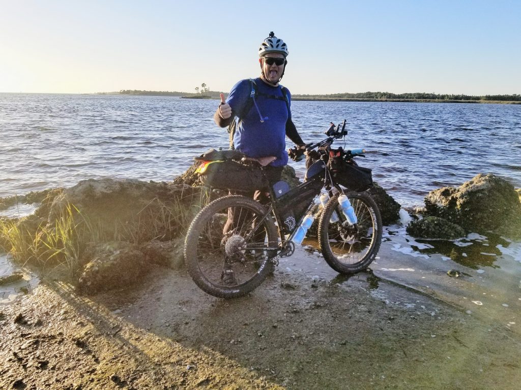
The 2017 Cross Florida Individual Time Trial (CFiTT) consisted of a 300+ mile route cross the state of Florida consisting of as many gravel, sandy, forest roads and hills that you can find in the state. In order to accomplish this, the route isn’t a straight line across the 60 mile wide state, but rather a nice north and south path to incorporate the Ocala National Forest.
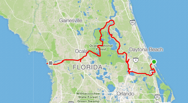
Thanks to Hurricane Irma, this year’s route was extra special. The Forts Gate Ferry was out of commission, so the reroute added about 50+/- miles on to the usual 250+ mile course. In addition, the weather proved to be unseasonably cold this year, with lows dropping in to the 30s for the 3 nights we planned to be out there.
Preparation

To tackle this 300 mile route takes a special kind of crazy, and a little bit of preparation. I worked with my training and riding partner, Rob, to develop a daily plan sheet for the adventure. We targeted 4 days to complete, hopefully leaving a nice easy 4 hour day at the end.
Our plan included:
- Re Supplies (both on and off route)
- Target daily mileage
- Ideal camping locations
The plan didn’t survive first contact with the CFiTT course.
Logistics were fun, as Rob and I drove a car over to the West Coast on Thursday night, ahead of Saturday’s Grand Depart. This 5 hour round trip acted as motivation to finish the course. Since the vehicle was our ride home, there was no choice but to finish.
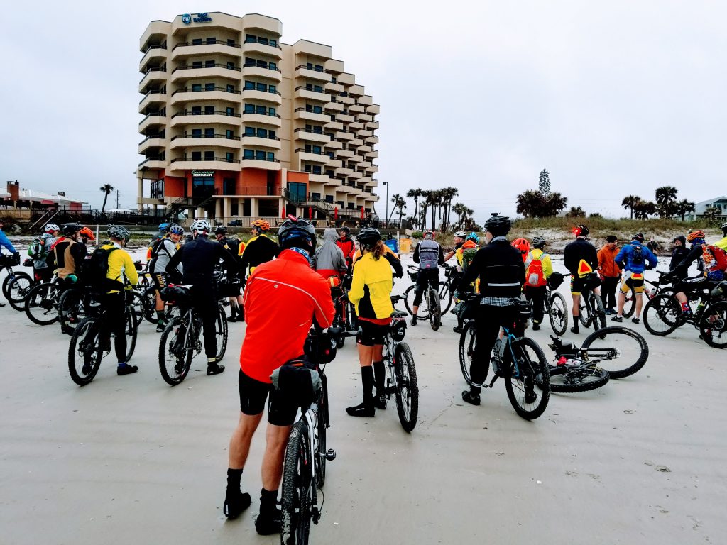
Day 1 – The Grand Depart
Day one began on a cold Florida morning (40-ish degrees), with a light mist of rain. Everyone gathered for the Grand Depart at 8:00a, and we were off.
Leaving from the East Coast, the first 60-70 miles was boring pavement riding for the majority of Maytown Road.
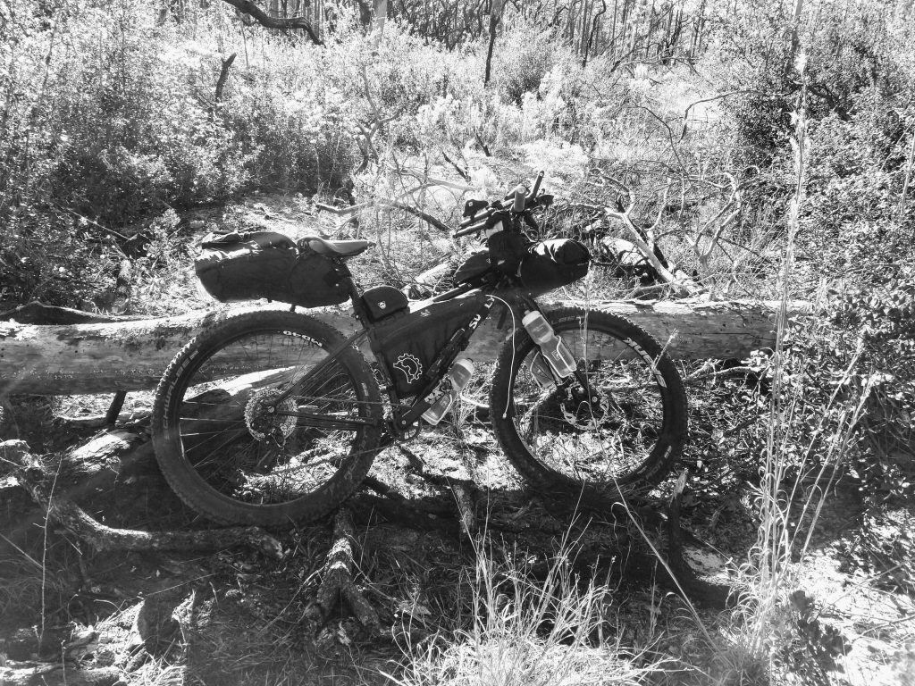
Challenge of the day: Chuck Lennon park came along at mile 80ish. Riding the hard trails with all the hard options made its way for a lot of hike-a-biking. Riding a fully loaded rigid bike wasn’t optimal on singletrack I was unfamiliar with and in the dark.

We ended up making it to our camping location around 10:00p. Naturally the GPS read about 5 miles longer than what our planning sheet showed.
The temperatures had dropped rapidly, so it was a quick setup and scramble in to our tents. This made it fun to conduct a bio-breaks in the middle of the night. On the bright side the cold did keep the mosquitoes away.
Day 2 – From Welaka to Palatka
In an attempt to let the temperatures warm up, we didn’t roll out of our tents until the sun came up. I am always the last to get my gear back on my bike. We got back on the road somewhere around 10:00a. This was a really late start.
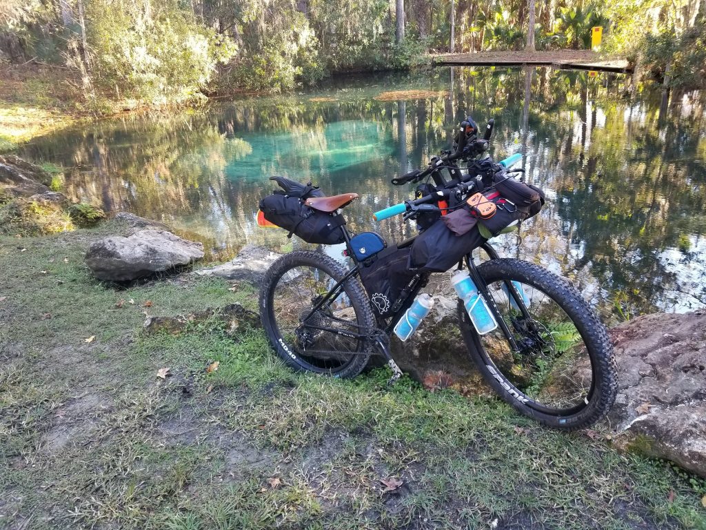
We encountered our first notable sight of the trip. The mud spring in the Welaka WMA. You would have to be lost to find it, but it was a great opportunity for some pictures.

There was a nice convenience store not too far off route from camp where we were able to get some food and continue on. With our late departure, we hit Shrimp R Us & More for a late lunch. This would be our last source of food until we hit Palatka.
Challenge of the day: Proved to be fighting fatigue. Once the sun went down, even road miles weren’t clicking off like they should.
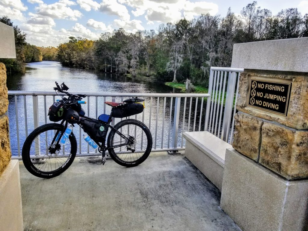
From Welaka to Palatka was a lot of road riding again. This was part of the re-route for the ferry being out of service and was to be expected. We hit the St. John’s River Bridge around 9:00p and ended up staying in Palatka for the night. Our miles just weren’t clicking off like they did on Day 1, and another 3 hours wasn’t ideal with the dropping temperatures. This was only about 60 miles on day 2. Well below our planned effort for the day.
Day 3 – From Palatka to Santos
Waking up in Palatka on the morning of Day 3 introduced a new challenge. Due to circumstances beyond his control, Rob would not be able to continue with the event. I would be completing the rest of the route solo.
As I left out of Palatka I hit the pavement with a mission to make up some miles. This was a little bit of a mistake as Rob is always my sense of reason on these types of rides. I have no concept of pacing.
One of the coolest sites of the day was the Rodman Dam. There were plenty of people out fishing, but Rodman Dam also marked the start of pedaling through some nasty, sandy trails. Although it wasn’t too hot out, the sun was in full force, and the effort I was expending on the sandy roads following the Rodman Dam was enough to make me rethink my clothing choice for the day. I was glad I had the 27.5×2.8 plus tires on the Karate Monkey, but in certain sections, even those weren’t enough to get me through.
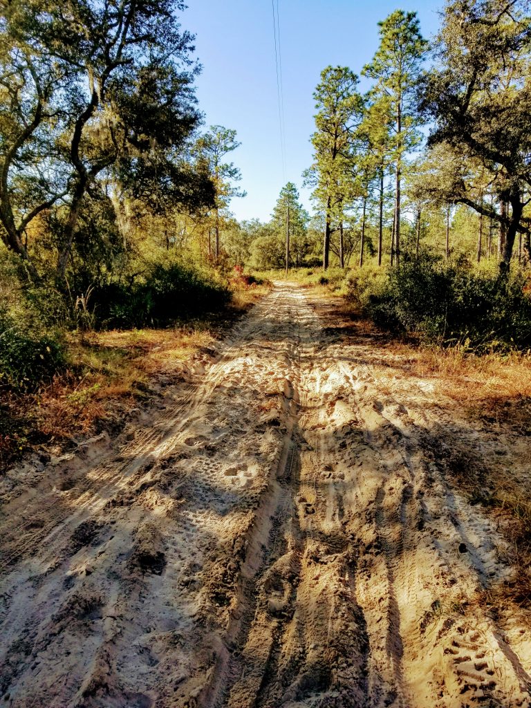

As I began into the sandy tracks, I recalled a rider we met on Day 2 (coming from West to East), who told us that it took him 6 hours to get from the 88 Store to Rodman Dam (12 miles). Based on the sand I was encountering I could see how this could be an issue, but it got more challenging from there.
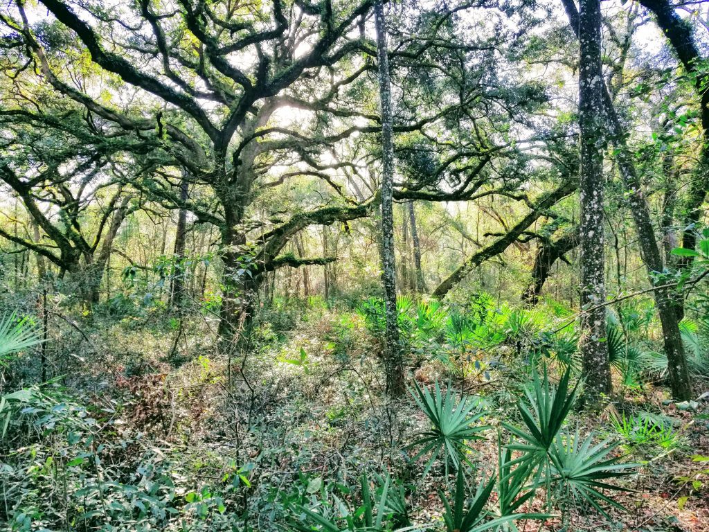
As I progressed past the sand I entered a trail which others are referring to as the “Ghost Trail”. There were no clear markings/paths to follow, and there was quite a bit of dead-fall on the route. Luckily passing this in the day, I was able to pick up on downed vegetation to lead the path in difficult areas. There are some advantages for being at the back of the pack.
Somewhere near the end of the Ghost Trail, I came across a group of riders, where I met some new friends, and a new riding buddy, Craig, who I would finish this CFiTT with. As we progressed to the next scheduled stop, the 88 Store, we came across some fresh bear scatt. There was even a guy sitting in a backyard who indicated 3 black bears had just been through his yard a few moments before we came through.
The 88 Store had a nice frozen cheeseburger and microwave which I used to get something  other than Fritos in my stomach for the day. As I ate my “lunch” the group I met on the Ghost Trail and I had a great conversation about the remainder of the route, targets for the day and our plans to finish. It was at this point that Craig and I decided to depart the store together to keep each other company on the remainder of the route.
From the 88 Store onward, the day was pretty much a blur of forest and gravel roads, with some small sections of pavement to connect things up.
We ended up finding the Mobil “Super Deli” around 8p and grabbed some much needed food. We also got to see some interesting characters in the convenience store. From there we were only a couple of minutes from Greenway Cycles, which of course was closed at this time of the night.
Entering the trailheads at Santos, we followed the signs for the Epic, and rode about another hour and a half before calling it quits for the night.
Day 4 – The Big Finish
Target for the Day: Get to the finish line
The morning started with a nice breakfast at Cracker Barrel in Ocala, from there we headed back in to the woods to tackle the remainder of the course.
We jumped back in to the Santos trails and came up to the Land Bridge (which doesn’t have so much land anymore). The last time I had been to this section of track, the Land Bridge was still dirt and rock. Now, it has a section of pavement running right down the middle of it. This just goes to show how long it had been since I had ridden the Santos trails.

The single track following the Land Bridge was harder than I remembered. Of course, riding for 4 days with a fully loaded rigid bike might have contributed to the difficulty. Getting out of the Santos trails was extremely slow going. Craig and I were averaging less than 7mph. Our dreams of a 4-5 hour day, was quickly becoming another full 8 hours in the saddle.
The last checkpoint, the bridge over the Coochee, was a welcome site. The last restock was within a mile, and the finish was only 3 hours away.
For the last of convenience store food, we stopped at the Sunoco and ran in to several other riders. We did the usual story telling of the route, and then mustered the courage to get back on the bikes for a pedal to the finish.

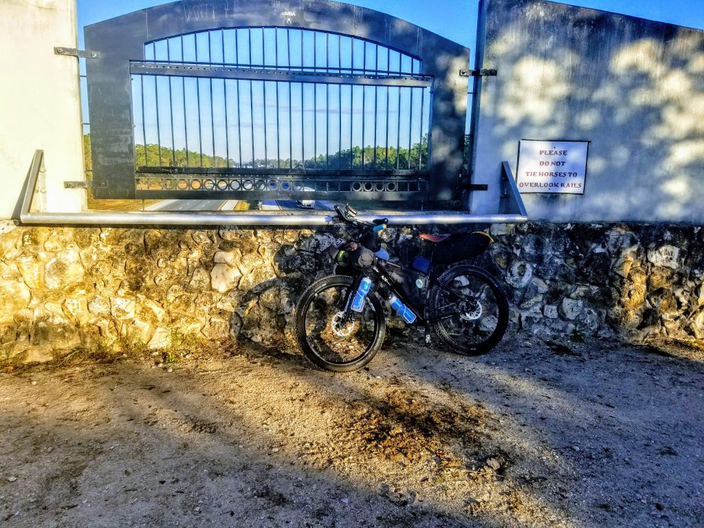
After we left the gas station the route wound us through a series of neighborhoods with gravel roads and rolling hills. We eventually came to a barbed wire fence which we had to lift our bikes over. This one was memorable, because it had a sign that said trespassers would be met with an “armed response”. I wish I would have gotten a picture of it, but I just wanted to get done. From here it was on to the finish on the, which had to be the longest 4+ miles of the trip on the paved bike path known to man.
The expedition was awesome:
- Saw parts of Florida that most people don’t even know exist
- Met new people and made new friends
- Tested my physical and mental limits
Best Part of the Trip
The story wouldn’t be complete if I didn’t say the best part of the trip was coming home and having my wife, kids and parents surprise me when I walked in the door. This wouldn’t be possible without their support and encouragement, and I am humbled and grateful to have it.